Three Credits – December 28, 2026 – January 13, 2027
Four Credits – December 28, 2026 – January 18, 2027
Application Deadline: June 30, 2026
Contact nuri.uzunlar@sdsmt.edu to be waitlisted.
The Geology of New Zealand Field Camp
Three Semester Credits
Four Semester Credits
December 28, 2026 – January 13, 2027 - Three Credits
December 28, 2026 – January 18, 2027 - Four Credits
New Zealand
December 28, 2026
January 13 and January 18, 2027
$4,295.00
$5,295.00
$300 is due at registration
June 30, 2026
First 15 confirmed students
No Camping
Undergraduate – $5,295.00 – Four Credits and $4,295 -Three credits
Cost: Graduate – Contact Dr. Uzunlar Nuri.Uzunlar@sdsmt.edu
Deposit $300 (required upon registration). Cost includes tuition, fees, food, lodging and transportation to field sites from Christchurch. Cost does not include airfare. Students will be picked up and dropped off at Christchurch Airport (CHC) for the 3- and 4-credit camps. As of October 1, 2019, students will need to request an Electronic Travel Authority (ETA). Learn more here https://www.immigration.govt.nz/new-zealand-visas/visas/visa/nzeta.
Registration is limited to the first 15 confirmed students.
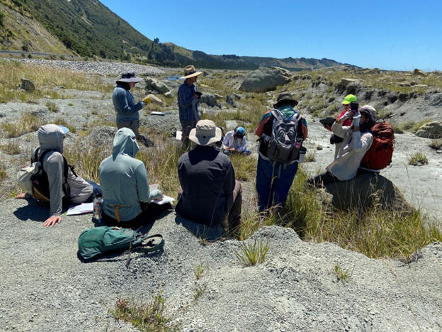
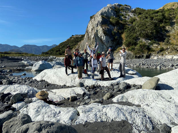
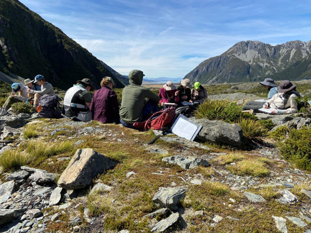
This is a newly redesigned course at South Dakota Mines addressing field geology topics that are important, timely and challenging. Starting and finishing in Christchurch for this fifth edition of the course, our New Zealand field camp gives students an integrated understanding of the broad scope of sedimentary basin analysis, sedimentation, stratigraphy, structure, active tectonics, geophysics and geomorphology.
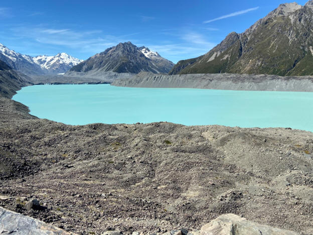
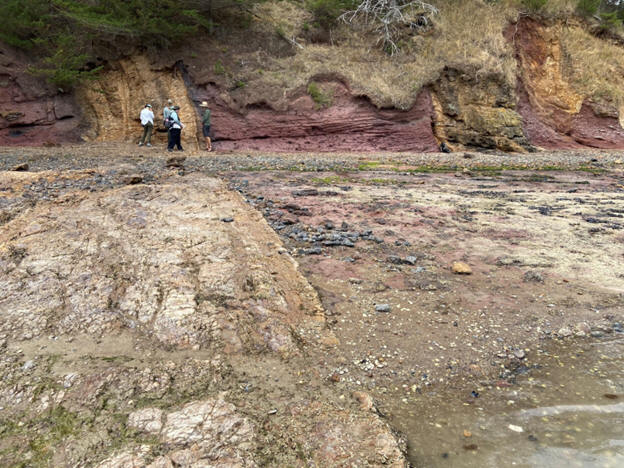
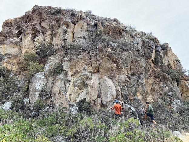
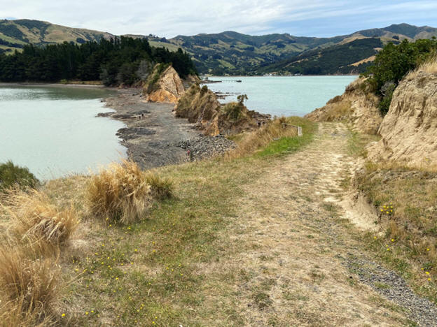
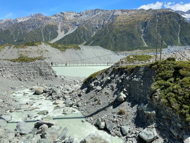
Co-taught by our team of sedimentary and structural geologists, this field camp covers the geology of the South Island of New Zealand. Our field camp is divided into five main themes: 1) mixed carbonate and clastic sedimentology, stratigraphy and geomorphology (Cenozoic) of the Kaikoura region; 2) active tectonics and earthquake fault rupture mapping of the Kaikoura and Hope faults; 3) South Island plate boundary active tectonics, tectonic sedimentation and highly deformed metamorphic basement rock assemblages east of Hokitika and along the Alpine fault; 4) basement mapping, alpine glacial geomorphology and tectonic sedimentation of the Mt Cook/ Aoraki area; and 5) igneous mapping of a volcanic complex of the Banks Peninsula (Miocene). While all mapping projects are completed on the South Island for this fifth edition of the course, some course lectures discuss the geology of previous mapping projects in the Taupo volcanic zone, Taranaki and East Coast basins, and the basement geology and faults of the Wellington area.
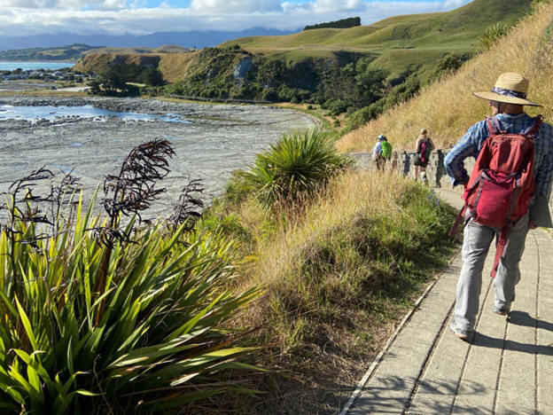
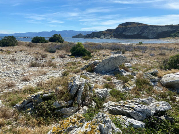
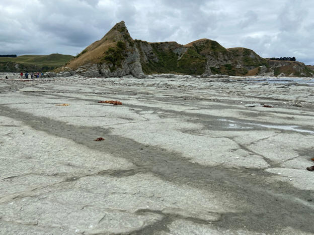
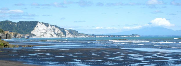
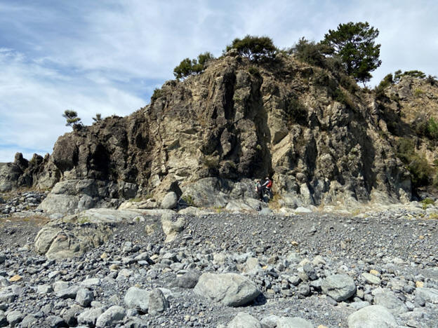
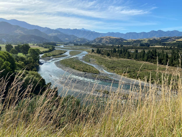
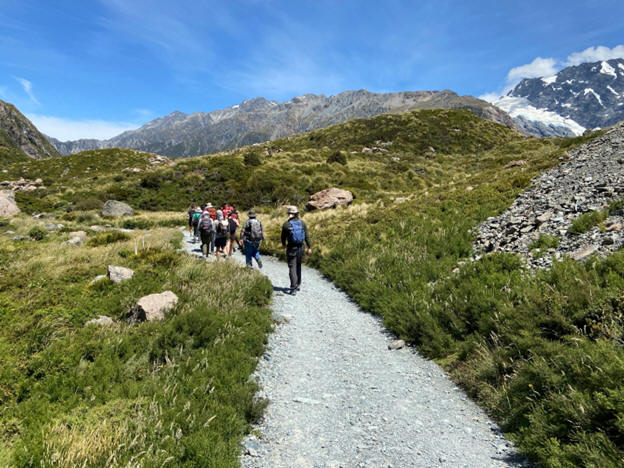
Field mapping areas featured in this course are known for their world-class outcrop exposures. Field areas include the coastal rocky beaches and wave cut platforms, to the inland foothills, to the tallest mountains (Southern Alps) of the country. This is an opportunity to learn about the structural evolution of New Zealand and its basins from the Cenozoic through today due to the complex interaction of tectonics, sedimentation and surface processes..
The five-project course is designed to provide students an opportunity to compare complex geological processes recorded in several types of basin settings associated with the Australian and Pacific plate boundary. Key methods pertaining to source-to-sink (S2S) sediment transport and sequence stratigraphy will be applied in mapping projects throughout the course. The structural and stratigraphic projects in this course are in part based on recent publications, including a new textbook on the broad topic of marine sedimentary geology by Rotzien et al (2022; Deepwater Sedimentary Systems: Science, Discovery and Applications – Elsevier, 2022, 806 p.). These field areas have been applied as analogs for decades to help understand the subsurface geology in both active and passive margin settings around the world.
Key mapping exercises will emphasize preparation of stratigraphic columns, geologic maps, structural cross sections, depositional system models, stereonets (using computer software) and completion of formal reports. Successive projects will involve greater geologic complexity, and one project will emphasize the assessment of energy resources. Subsurface data including seismic data and well logs will be used to illustrate key points on the structure, tectonics and overall formation of sedimentary basins. Mapping in this course will provide practical applications to interpreting subsurface geology, including resource exploration and development (i.e., new ventures, exploration, development and production of oil and natural gas) and geological hazards (use of LiDAR, earthquake and landslide hazards assessments, risks, mitigations). These skills are also extensively used for mapping the subsurface in the broad field of environmental sciences. Mapping techniques practiced in this course prepare students for roles in industry, government, academia and geotechnical engineering. Interactions with professional geoscientists during the trip provide a panel of perspectives about what it is like to live and to work as a geoscientist in New Zealand.
Sedimentology, stratigraphy, mineralogy, petrology, structural geology. Geophysics is helpful but not required. Exceptions considered on request. In your application to the South Dakota Mines field course, briefly tell us why you wish to attend this field course, and what you aim to get out of the educational experience.
Field work will involve mapping remote areas and will include daily hikes of considerable length. Students should be physically and mentally prepared for work in coastal and mountainous terrain in New Zealand.
Weather in New Zealand during the summer months is generally fine. However, students should be prepared for hot days (90° F / 32° C), and cold, rainy weather (45° F / 7° C) during storms. Students should respect the variability in the daily tides and frequently changing weather patterns in the high elevations of the Southern Alps. In December 2023 to January 2024, temperatures for our camp ranged from about 40-80° F.
Lodging for the program will be cabin camping in holiday parks equipped with modern shared facilities. Our accommodations will roam with us. We will stay at the Alpine Pacific Lodge in Kaikoura, the Hokitika Holiday Park, Glentanner Station Holiday Park and Tasman Holiday Park in Christchurch. Students will need to supply their own bedding for the park in Hokitika (sheets or sleeping bag). All accommodations will have beds (no tent camping). All other accommodations are equipped with sheets and covers.
Color pencils I recommend these inexpensive ones (box of 72). Click Here .
A complete and detailed equipment list will be provided for participants.

Dr. Jon R. Rotzien
Instructor, South Dakota Mines & Black Hills Natural Sciences Field Station
Adjunct Professor, Dept. of Earth and Atmospheric Sciences
University of Houston Science and Research Building
Phone: (650) 862–0574
jonathan.rotzien@sdsmt.edu; jrotzien@uh.edu
Dr. Nuri Uzunlar, Director, Black Hills Natural Sciences Field Station
Professor, Geology and Geological Engineering Department
South Dakota School of Mines and Technology
Office Phone: (605) 394 – 2494 ; Cell: (605) 431-1275