|
|
The Geology of New Zealand Field Camp
Integrated Mapping Techniques for Understanding Sedimentation and Structure
Three Credits - December 28, 2026 - January 13, 2027
Four Credits - December 28, 2026 - January 18, 2027
Application Deadline: June 30, 2026
|
|
Cost: Undergraduate - $5,295.00 - Four Credits and
$4,295 -Three credits Cost: Graduate - Contact Dr. Uzunlar
Deposit $300 (required upon registration). Cost includes tuition, fees, food,
lodging and transportation to field sites from Christchurch. Cost does not
include airfare. Students will be picked up and dropped off at Christchurch
Airport (CHC) for the 3- and 4-credit camps. As of October 1, 2019, students
will need to request an Electronic Travel Authority (ETA). Learn more here https://www.immigration.govt.nz/new-zealand-visas/visas/visa/nzeta.
Registration is limited to the first 15 confirmed students. |
|
Introduction:This
is a newly redesigned course at South Dakota Mines addressing field geology
topics that are important, timely and challenging. Starting and finishing in
Christchurch for this fifth edition of the course, our New Zealand field camp
gives students an integrated understanding of the broad scope of sedimentary
basin analysis, sedimentation, stratigraphy, structure, active tectonics,
geophysics and geomorphology. Co-taught by our team of sedimentary and
structural geologists, this field camp covers the geology of the South Island of
New Zealand. Our field camp is divided into five main themes: 1) mixed carbonate
and clastic sedimentology, stratigraphy and geomorphology (Cenozoic) of the
Kaikoura region; 2) active tectonics and earthquake fault rupture mapping
of the Kaikoura and Hope faults; 3) South Island plate boundary active
tectonics, tectonic sedimentation and highly deformed metamorphic basement rock
assemblages east of Hokitika and along the Alpine fault; 4) basement mapping,
alpine glacial geomorphology and tectonic sedimentation of the Mt Cook/ Aoraki
area; and 5) igneous mapping of a volcanic complex of the Banks Peninsula
(Miocene). While all mapping projects are completed on the South Island for this
fifth edition of the course, some course lectures discuss the geology of
previous mapping projects in the Taupo volcanic zone, Taranaki and East Coast
basins, and the basement geology and faults of the Wellington area.
Field mapping
areas featured in this course are known for their world-class outcrop
exposures. Field areas include the coastal rocky beaches and wave cut
platforms, to the inland foothills, to the tallest mountains (Southern
Alps) of the country. This is an opportunity to learn about the
structural evolution of New Zealand and its basins from the Cenozoic
through today due to the complex interaction of tectonics, sedimentation
and surface processes.. The
five-project course is designed to provide students an opportunity to compare
complex geological processes recorded in several types of basin settings
associated with the Australian and Pacific plate boundary. Key methods
pertaining to source-to-sink (S2S) sediment transport and sequence stratigraphy
will be applied in mapping projects throughout the course. The structural and
stratigraphic projects in this course are in part based on recent publications,
including a new textbook on the broad topic of marine sedimentary geology by
Rotzien et al (2022; Deepwater Sedimentary Systems: Science, Discovery and
Applications – Elsevier, 2022, 806 p.). These field areas have been applied
as analogs for decades to help understand the subsurface geology in both active
and passive margin settings around the world. Key
mapping exercises will emphasize preparation of stratigraphic columns, geologic
maps, structural cross sections, depositional system models, stereonets (using
computer software) and completion of formal reports. Successive projects
will involve greater geologic complexity, and one project will emphasize the
assessment of energy resources. Subsurface data including seismic data and well
logs will be used to illustrate key points on the structure, tectonics and
overall formation of sedimentary basins. Mapping in this course will provide
practical applications to interpreting subsurface geology, including resource
exploration and development (i.e., new ventures, exploration, development and
production of oil and natural gas) and geological hazards (use of LiDAR,
earthquake and landslide hazards assessments, risks, mitigations). These skills
are also extensively used for mapping the subsurface in the broad field of
environmental sciences. Mapping techniques practiced in this course prepare
students for roles in industry, government, academia and geotechnical
engineering. Interactions with professional geoscientists during the trip
provide a panel of perspectives about what it is like to live and to work as a
geoscientist in New Zealand. By the end of the course, students will be able to:
·
Describe sediment
transport and depositional processes for a wide range of sedimentary deposits
including clastic and carbonate rocks, including fossil evidence,
·
Understand the stratigraphy
related to passive and active margin depositional systems including terrestrial,
coastal, shallow-marine, and deep-marine depositional environments,
·
Describe and apply
Cenozoic regional chronostratigraphy of New Zealand basins,
·
Understand both plate
tectonics and lithospheric architecture and their roles on the development of retroarc
foreland, hybrid and forearc basin depositional systems, as well as the role
that volcanism plays in basin architecture and sedimentary fill,
·
Recognize sediment
transport and depositional processes in marine depositional environments, and
competing models for basin sedimentation,
·
Characterize stratigraphic
intervals and build relationships with depositional environments using outcrop
(and behind-outcrop core), core and other industry data,
·
Characterize active
faults and earthquake-related surface deformation through mapping fault
scarps, landslides, uplifted marine and fluvial terraces, offset deposits, and
fault slip rates calculations,
·
Conceptualize and apply
source-to-sink transport and sequence stratigraphy to overall sediment delivery
to a basin,
·
Use lithofacies and stratigraphic
architecture to understand variations in reservoir properties pertaining to
reservoir presence, reservoir quality and seal presence,
·
Apply predictive
attributes to sedimentary basins in the context of resource exploration with
special attention to stratigraphic trapping mechanisms,
·
Apply skills in seismic
interpretation, reservoir characterization, core analysis, geophysical log
interpretation, sequence stratigraphy, play fairway mapping, risk and
uncertainty analysis, gross depositional environment mapping, and exploration
methods,
·
Characterize various
surface processes and their deposits in Quaternary geology.
·
Understand the role of ethnogeology
in the culture and history of New Zealand’s past, present, and future.
Prerequisites: Sedimentology, stratigraphy,
mineralogy, petrology, structural geology. Geophysics is helpful but not
required. Exceptions considered on request. In your application to the South
Dakota Mines field course, briefly tell us why you wish to attend this field
course, and what you aim to get out of the educational experience.
Physical demands: Field
work will involve mapping remote areas and will include daily hikes of
considerable length. Students should be physically and mentally prepared
for work in coastal and mountainous terrain in New Zealand.
Climate:Weather
in New Zealand during the summer months is generally fine. However,
students should be prepared for hot days (90° F / 32° C), and cold, rainy
weather (45° F / 7° C) during storms. Students should respect the variability in
the daily tides and frequently changing weather patterns in the high elevations
of the Southern Alps. In December 2023 to January 2024, temperatures for our
camp ranged from about 40-80° F.
Facilities:Lodging
for the program will be cabin camping in holiday parks equipped with modern
shared facilities. Our accommodations will roam with us. We will stay at
the Alpine Pacific Lodge in Kaikoura, the Hokitika Holiday Park, Glentanner
Station Holiday Park and Tasman Holiday Park in Christchurch. Students will need
to supply their own bedding for the park in Hokitika (sheets or sleeping
bag). All accommodations will have beds (no tent camping). All other
accommodations are equipped with sheets and covers.
Other required equipment: Basic
geology tools including hammer, hand lens, write-in-the-rain notebook, map case,
colored pencils, Brunton compass (or equivalent – Southern Hemisphere) tuned to
the declination of New Zealand. Students will need a laptop for written
reports. Suitable clothing for working in hot, coastal environments and cool,
mountainous environments including wide-brimmed hat, sun-proof shirts and pants,
sturdy boots, and appropriate socks is required. A complete and detailed
equipment list will be provided for students ahead of the camp.
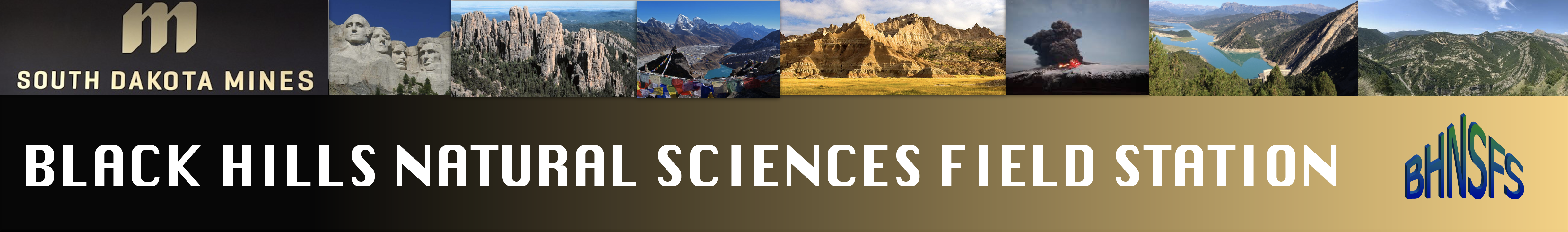
View
of one of the first mapping areas with the Kaikoura Range in the distance.
Descending onto the wave cut platform to collect data for one of the first
mapping areas. Routine map data collected include rock type, bedding attitude,
contacts and structural measurements including attitudes of joints and faults.
In this project, at least three terraces will be identified, characterized and
interpreted in the context of New Zealand’s recent history of coastal uplift.
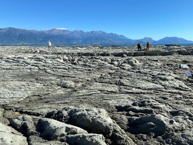
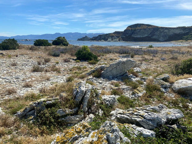
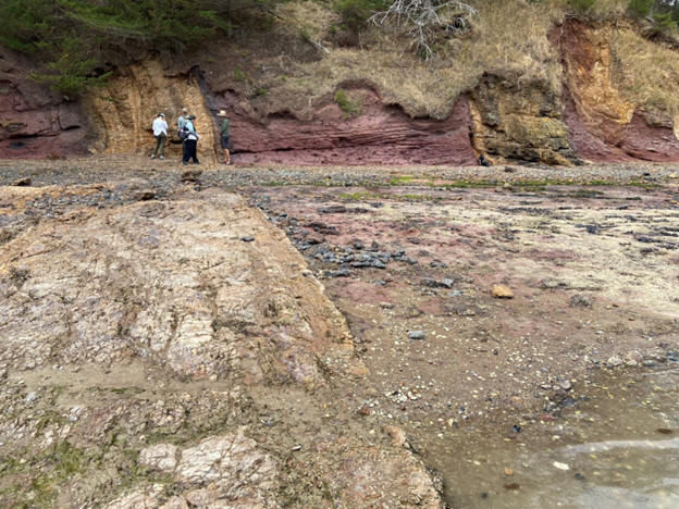
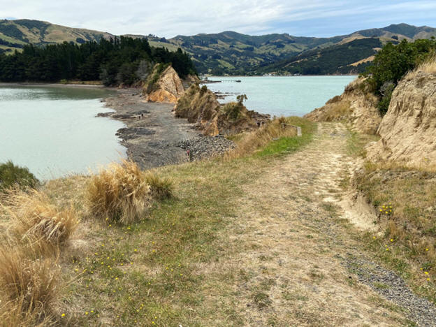
One
of our field mapping areas stretching along the Kaikoura coast. The majority of
the first projects will occur along the beaches of northern Canterbury, where
the outcrop exposures provide exceptional access to view the broad variation of
Neogene sedimentary basin fill and evidence for Recent tectonism. 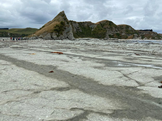
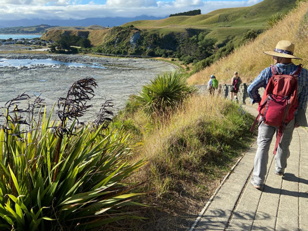
Various types of
carbonate rocks, conglomerate, sandstone and mudstone are common deposits that
accumulate in marine environments and are the products of diverse sedimentation
processes. Because of their variable porous and permeable nature, these deposits
also form reservoirs around the world in active and passive margin settings.
Mapping and interpreting their characteristics using first principles helps to
interpret the history of sedimentary basin fill and to build depositional
models. Most of our mapping for the first part of the course occurs along modern
beaches and wave-cut platforms, such as Whalers Bay on the Kaikoura Peninsula.
View south from Tongaporutu River of the Upper Mount Messenger Formation outcrop
exposures in the 250-m-tall Whitecliffs. These deposits are interpreted to
represent a submarine apron near the base of slope. These marine depositional
systems will be compared and contrasted with perched, ponded, and stepped
continental slopes, as well as variations of submarine fans including fan
valleys and unconfined fans during this field course. Mt Taranaki is in the
distance (far right) with a cloud at its summit. Note the black sand beaches
composed of titanomagnetite. Some of these beaches are mined for their iron
content. Much of this map area has been published in journals, special
publications, field guides and textbooks.
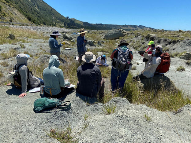
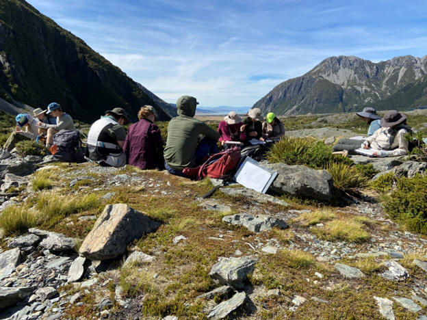
Camp days generally begin with a short drive to the field area followed by a
safety moment, introduction to the mapping exercise, observation and
collaborative group discussion. For the rest of the day, student teams cover the
mapping area and complete their maps to turn in at the end of the day. Above:
can you identify the Papatea fault scarp?
Measuring a stratigraphic section through a deepwater sedimentary interval with
the aim of interpreting the processes of sedimentation, stratigraphic and
depositional architecture and overall evolution of the depositional system.
Deepwater sedimentary systems result from some of the largest sediment movements
on Earth. Deepwater environments represent the final resting place for sediment
on Earth and are important to understand as the ultimate sink for a number of
elements including organic carbon as well as REE and important metals.
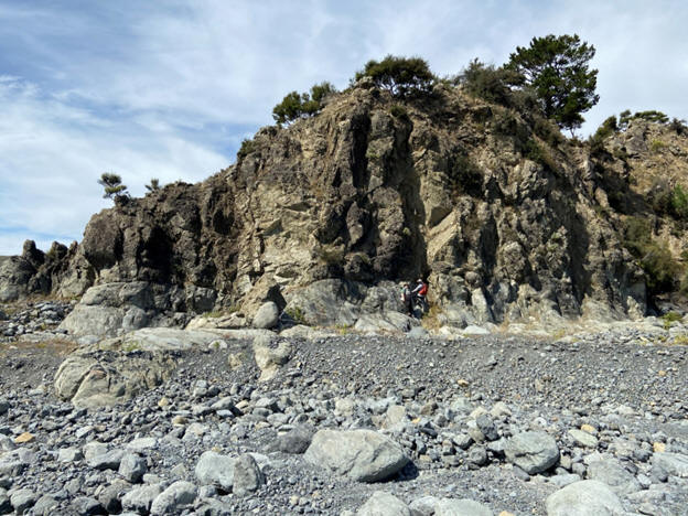
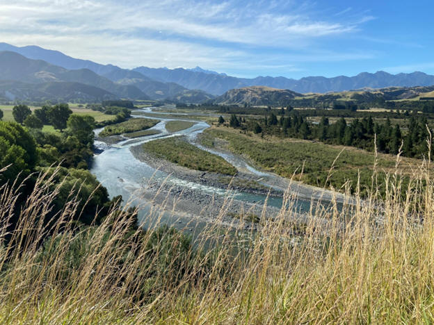
View along the Clarence River, one of the field mapping areas in which we will
use LiDAR to get a higher resolution understanding of how modern seismic events
have influenced the geomorphology.
Fault mapping and analysis project from the Kaikoura 7.8 magnitude earthquake
(2016).
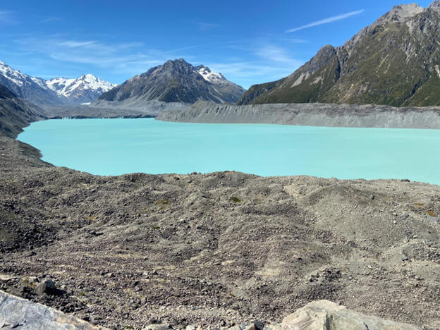
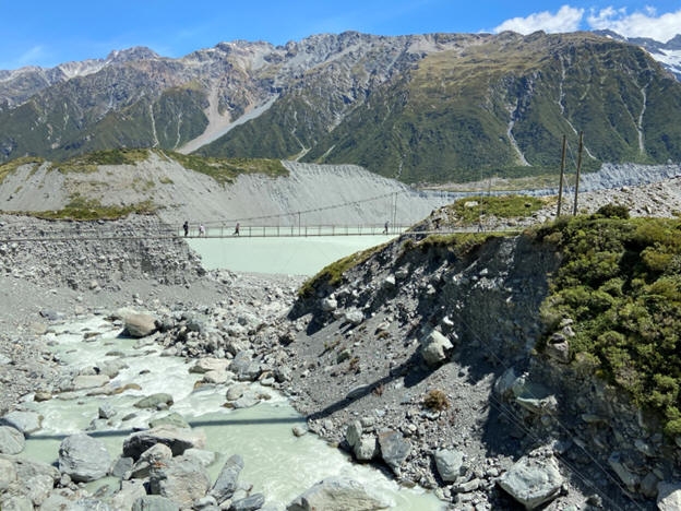
Mapping glacial geomorphology and interpreting basement rock assemblages, with a
view south to Lake Pukaki. 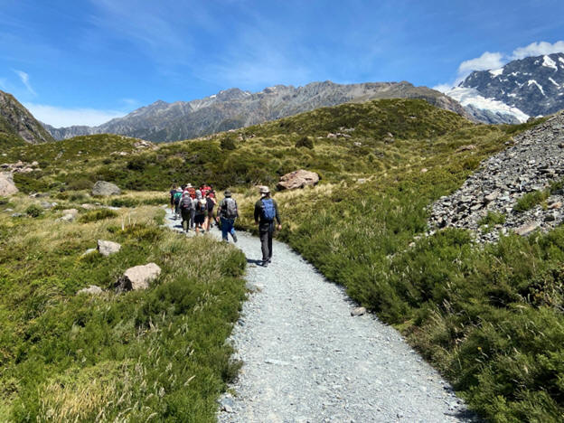
Hiking along the
moraines and glacial outwash south of Mt Cook/ Aoraki.
While at Glentanner, students will have the opportunity to map the basement
rocks and sedimentary features exposed in the Mt Cook/ Aoraki area and interpret
the relationships among various sedimentary processes, including gravitational
movements and fluid flow – and their deposits – in order to understand how
glacial depositional systems evolve in the Mackenzie Basin. Tasman Glacier and
Lake shown above, with lateral and terminal moraines. Mt Cook/ Aoraki is in the
distance.
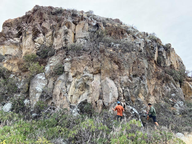
Mapping on the Banks Peninsula southeast of Christchurch in order to determine
the petrology, mechanism of emplacement and overall evolution of the Lyttleton
and Akaroa volcanic centers.
Participants examine volcanic deposits of the Lyttleton volcanic center
southeast of Christchurch.
The
course concludes with a visit to the Banks Peninsula to determine the petrology,
architecture, relative timing and emplacement of the two volcanic centers
located to the southeast of the city of Christchurch. While these are Miocene
features, volcanism continues to play a key role in the architecture and filling
of basins throughout New Zealand today.
For more information, please contact: Dr. Jon R. Rotzien
Instructor, South Dakota Mines & Black Hills Natural Sciences Field Station
Adjunct Professor, Dept. of Earth and Atmospheric Sciences
University of Houston Science and Research Building M:
(650) 862–0574
jonathan.rotzien@sdsmt.edu;
jrotzien@uh.edu
or
Dr. Nuri Uzunlar Director, Black Hills Natural Sciences Field Station Professor, Geology and Geological Engineering Department South Dakota School of Mines and Technology Phone: (605) 431-1275
|