|
|
|
Geology Field Camp
Atlas Mountains, Morocco
GEOL 410 Field Geology - Six semester credits Not offered in 2026
May 18 - June 19, 2027
Application Deadline: March 31, 2026
|
|
|
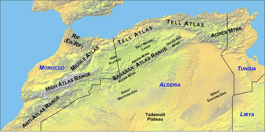
Location: Field camp will be based in a small town called Tafraoute at the heart of the Anti-Atlas Mountains about 379 km (5 h 13 min) south of Marrakesh Menara Airport, Marrakesh, Morocco and 143 km (2 h 30 min) from south of Agadir Al Massira Airport, Agadir Morocco. We are going to stay in Hotel L'Arganier d'Ammelne: This hotel has been base location for University of Ibn Zohr undergraduate students field trip for a long time. This hotel is very nice, far from the city of Tafraoute and has a beautiful view the Jbel Lkest (Lkest Mountain). It has a swinging pool, a jacuzzi, laundry facility and open courtyard. The manager is very approachable, friendly and allowed us to have the place to ourselves during our field camp. There are 16 rooms in this place, a restaurant with Moroccan food and conference room at our disposal. Introduction: The Anti-Atlas Mountains extends from southern foothills of the High Atlas Mountains to northwest of Sahar Desert. Its climate ranges from arid to semi-arid condition with major influence by orographic effect of the High Atlas and the Atlantic Ocean with annual precipitation ranges from 100 to 200 mm per year. The Anti-Atlas Mountains are part of a mountain chain in southern Morocco which represent the oldest crystalline rocks in Morocco with diversified landscape, made of Precambrian crystalline (Kerdous) and granitic mountains (Tafraoute laccolith) with highest elevation Jebel Siroua (3300 m). This region of Morocco is occupied by Berber-speaking indigenous people with exceptional hospitable traditions. This field camp will be focused on mapping Precambrian metamorphic, igneous as well as sedimentary rocks and early Paleozoic strata. This includes mapping stratigraphic units that record the transition from the end of Precambrian conglomerate and quartzite and Cambrian transgression of dolomite sequences. These sections represent part of the breakup of the Gondwana supercontinent. You will have the opportunity to map sedimentary, igneous and metamorphic rocks as well as complex tectonic structures that built one of the main mountain ranges in north Africa. These rocks are building blocks of the Gondwana supercontinent, onset of the Pangaea supercontinent spreading, and the opening of the Atlantic Ocean and Cenozoic orogeny event. In addition to extraordinary geology, you will have the opportunity to take in the magnificent culture of Morocco through local and regional interactions coordinated by the Moroccan-native instructor. Prerequisites: completion of junior year of study, Physical Geology, Mineralogy, Petrology, Stratigraphy/Sedimentation, and Structural Geology, or consent of the Director Physical demands: We will be hiking and walking for most of the day and this requires you to be in good physical shape and good health. Climate: Moderate to subtropical, coastal regions are cooled by breeze from the Atlantic Ocean and the Mediterranean Sea. To the interior, hot temperatures during summer and cold in the winters. More arid climate to the south at the foothills of the Sahara Desert. Required Books: · Compton’s “Geology in the Field”, or Geologic Field Techniques (1st edition) edited by Angela Coe · Field Notebooks for taking field notes, recording evening lectures, etc. Field and Drafting Equipment: · Geology hammer/pick · Hammer holster (optional, very useful) · Hand lens (can be purchased at the online) · Small acid bottle (we can sell you a bottle for $5.00; we will furnish 10% HCl) · Engineer’s/field notebook (legal pads, spiral notebooks, etc. are not suitable) · Mapping board/clipboard · White out · Day pack · Scientific calculator · 2-4 liter water bladder or 2-4 1-liter water bottles · Pencils (3H, 4H, and 6H) · Drafting pens (0 and 1 at a minimum; 00 and 2 are helpful; permanent ink) · Protractor (on 6-inch ruler) · Scales 1:10, 1:20; 1:30; 1:50; 1:100 · Triangles (30-60o, 45o) · Colored pencils (at least 6; 12 set recommended) · T-square (optional, but very useful) · Drafting board (optional, but very useful) Field Clothing: · Waterproof Field boots (with a gripping sole, although neoprene is not recommended; ankle-high boots are best – most important part of your field gear) · Heavy socks (light socks for liners help prevent blisters; 6-7 pair) · Field pants (several pair) · Field shirts (lightweight, long and short-sleeved) · Sweatshirt, warm jacket, or sweater · Windbreaker/rain gear (waterproof jacket/pants) · Hat and sunglasses · Field vest (optional, but very useful) Other Personal Items: · Flashlight · Sunglasses · Set of light clothing for town · Light everyday shoes or moccasins · Swimming suit, towel, · Insect repellent · Lip balm · Sun tan lotion (at least SPF 15) · Small roll of duct tape · Camera, binoculars · OTC/Prescription medication, especially for allergies Laptop computer: · Bring your own personal laptop computer (used for word processing – writing report). 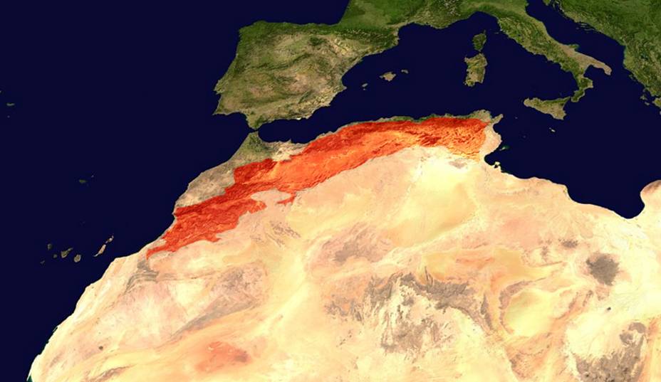 Geographic location of Atlas Mountains. The chain extends from the Atlantic Ocean to Tunisia, north Africa.
Topographic relief map of Atlas Mountains and its different subdivisions in north Africa.
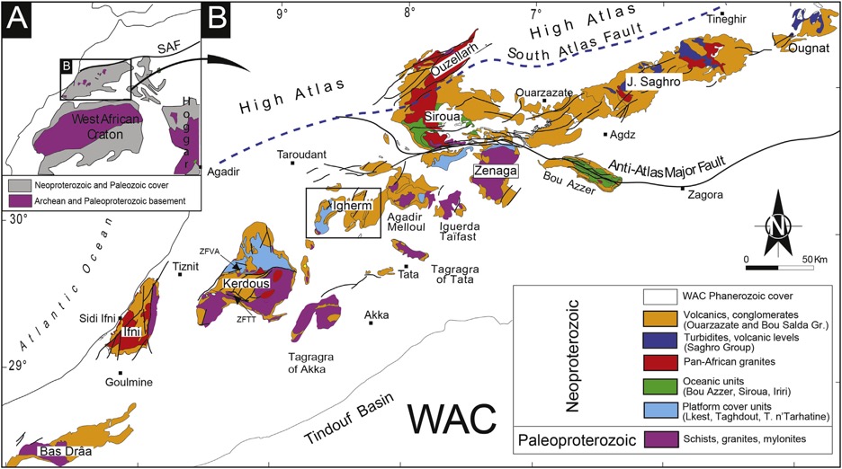
Geological map of the Anti-Atlas Mountains and its relationship to west African Craton Ikenne et al., (2017).
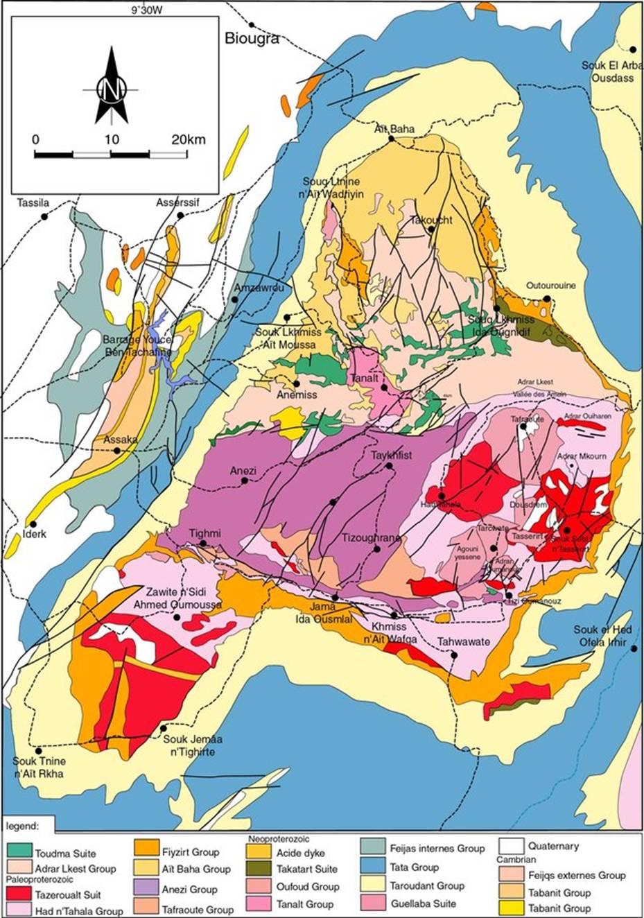
Geological map of the Kerdous Inlier (Soulaimani and Ouanaimi, 2011).
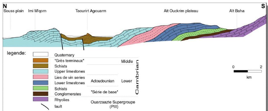
Geological cross-section of the lower Cambrian units (Choubert, 1952).
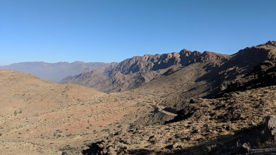
Kerdous Inlier.
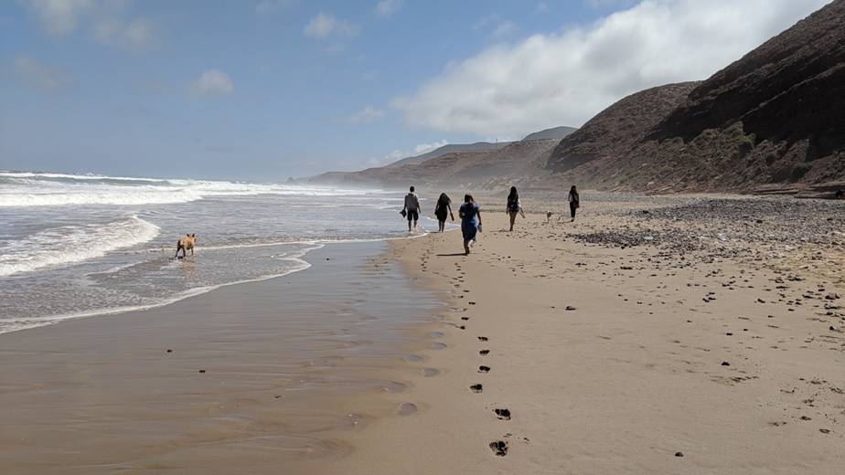
Free day at the beach. For more information contact:
Dr. Nuri Uzunlar, Director, Black Hills Natural Sciences Field Station Professor, Geology and Geological Engineering Department South Dakota School of Mines and Technology Office Phone: (605) 394 - 2494 ; Cell: (605) 431-1275
|