|
|
Geology Field Camp
Montana GEOL 410 Field Geology - Six semester credits
Dates: May 17 - June 18, 2026
Application Deadline: April 30, 2026
|
|
Cost: $5,695.00. Deposit $300 (required upon registration). Cost includes tuition, fees, food, lodging and transportation to field sites and from Bozeman to Dillon and back to Bozeman. Cost does not include airfare to Bozeman.
Important Dates: Students will be picked up in Bozeman at 2:00 PM on May 17 and drive to Dillon. We will have drop off at Bozeman airport before 11:00 AM on June 18. If you are driving you can check in at Western Montana College in Dillon on May 17. Earliest you can leave camp is June 17, 6:00PM
Each session is limited to 20 students
|
|
Introduction:
The scenic Montana Rockies of southwest Montana consists of rocks that span
almost all of geologic time and are deformed and modified by a diverse set of
geologic structures and processes. As such they provide an ideal setting for
students to develop and hone their observational, mapping, and critical thinking
skills during a. series of two day to one-week long geologic mapping exercises
during this immersive 5-week field course.
Prerequisites:
Physical geology, mineralogy and/or petrology and structural geology required;
volcanology and geomorphology helpful but not required. Projects: Get ready for an immersive geologic field
experience like no other! Over the course of this field program, students will
develop critical skills in geologic field observations, map construction,
stratigraphic section measurements, and structural analysis. You’ll interpret
geologic history through both stratigraphic and structural relationships
examined in the field. Most projects will focus on mapping using topographic base
maps at various scales, with all data compiled directly in the field. Mapping Highlights: Our fieldwork will include
in-depth studies of formations spanning the Archean, Paleozoic, Mesozoic, and
Cenozoic eras. Key topics include:
Epic Road Trip to Geological Wonders! For one week,
we’ll embark on an unforgettable geology-focused road trip exploring some
of the most spectacular geological sites in the country:
This road trip will be more than just sightseeing! Students
will be responsible for completing deliverables along the way, including:
Physical Demands: Prepare for rigorous fieldwork!
You’ll be traversing rugged, steep terrain, including demanding hikes with
significant elevation gain. Students should be both physically and mentally
ready to work in these challenging conditions. Facilities: Lodging will be at the University of
Montana Western dormitories in Dillon, Montana. Students will typically stay in
double-occupancy rooms (depending on availability). Amenities include
bedding, cafeteria food services, laundry facilities, cell service, Wi-Fi, and
local shopping. Climate: Springtime in the Montana Rockies is
highly unpredictable. Expect a mix of warm, pleasant days and sudden cold,
windy, or wet conditions. About half of our fieldwork will take place at
higher elevations (~7,000 feet), where solar radiation is intense. Average
temperatures range from low 60s to high 70s°F during the day and mid-30s to
mid-40s°F at night. Bring layers! Textbooks:
This will be an unforgettable field experience that
blends adventure with hands-on learning in some of the most geologically rich
regions of North America. Get ready for an incredible journey! Field Equipment: (items can be purchased on campus
at UMW if necessary) a. Geologic rock hammer and hammer holder b. Hand lens (10x) c. Mechanical and colored pencils (#2 lead (or harder)
and variety of colors), d. (2) Pilot extra fine (0.5, 1.0) black RT pens e. Weatherproof geological field notebook(s) (gridded
recommended) f. Protractor, ruler (English and Metric units) g. Daypack and/or field vest for carrying field
supplies h. Clipboard or map case with a clear plexiglass cover
(see brunton website) i. H2O bottles or hydration-pack j. Pocket knife (good for a lot of things as well as
a scratch test tool) k. Grain-size chart (optional) l. Safety glasses (not necessary if you use any
other type of glasses) m. Calculator n. Laptop computer o. Sunscreen p. Lip balm q. Sunglasses r. Color pencils I recommend these inexpensive ones (box of
72)
here Field clothing: a. Sturdy hiking boots (mandatory) and a secondary
pair of shoes just in case your primary gets wet. b. Rain jacket (make sure is impermeable, hypothermia
due to getting wet in cold weather is real) c. Fleece jacket (idea is to dress in thin, light, and
breathable layers that can be added or subtracted according to conditions) d. Light-weight leather work gloves, e. Field hat (full brim). f. belt g. sandals h. warm jacket to keep you warm in 40 degree weather i. beanie j. Towel Camping (during road trip only)
During camping, we will bring stoves to share and form
cooking teams with similar food restrictions.
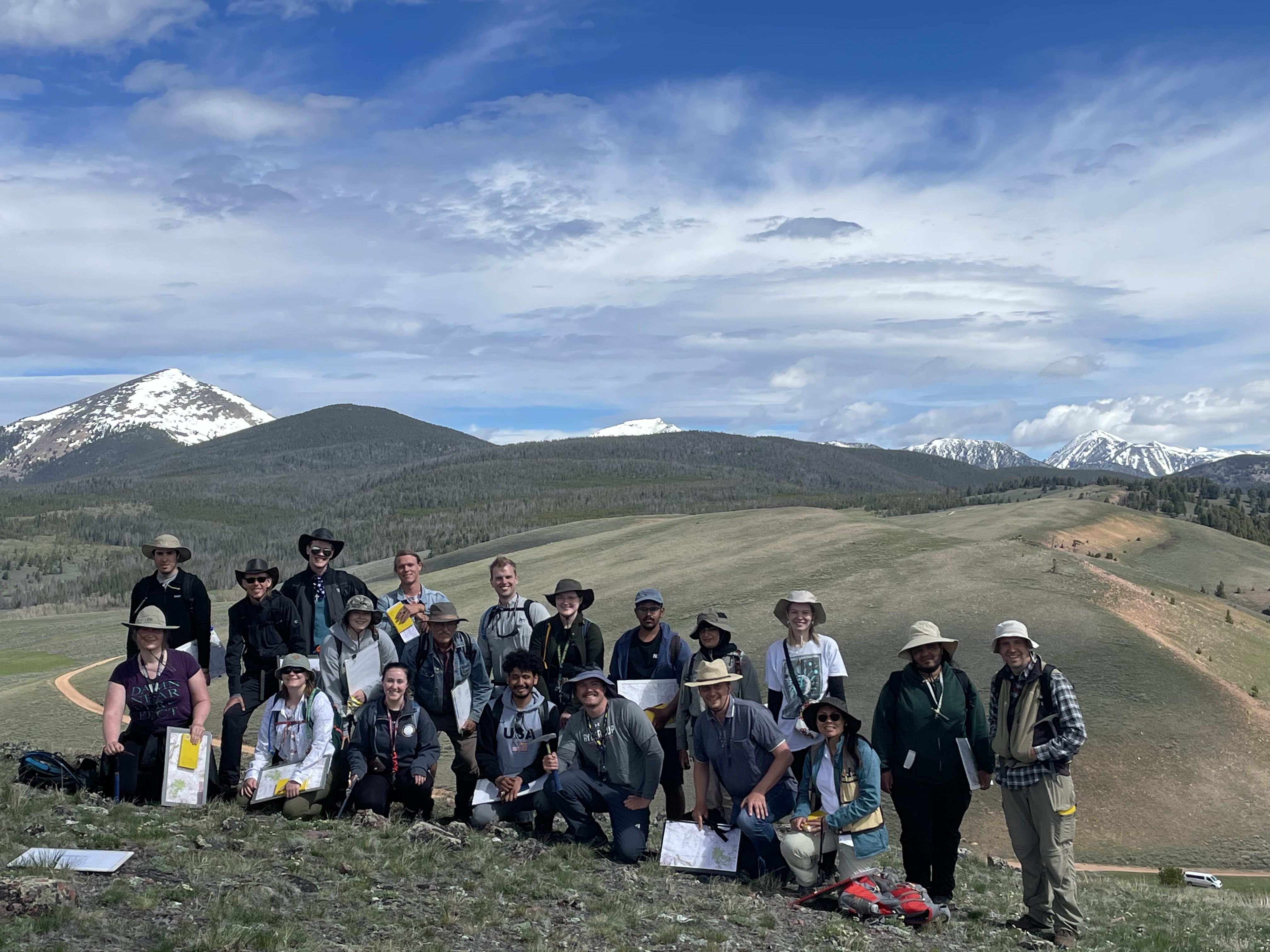
Group photo
For more information contact:
Dr. Nuri Uzunlar Director, Black Hills Natural Sciences Field Station Professor, Geology and Geological Engineering Department South Dakota School of Mines and Technology Phone: (605) 431-1275
|