Contact nuri.uzunlar@sdsmt.edu to be waitlisted.
Depositional Systems Field Camp
Three Credits
Big Sur - Western California
$3,895
$4,995.00
$3,895. Cost includes all meals, lodging and transportation from and to San Jose airport. Meeting location and other logistics info will be emailed to participants.
Late Cretaceous to Paleogene deep-water deposits are spectacularly exposed along the coast of western California. This is an opportunity to map and interpret the stratigraphic evolution of canyon, channel-fill, levee, splay (lobe), and overbank clastic assemblages deposited in a forearc basin setting. The processes of sedimentation and architecture of mudstone- and conglomerate-rich strata will be featured from shelf to basin floor. These depositional systems are applied as analogs to help understand geologic risk in deep-water drilling programs in both active and passive margin plays. The history of exploration into these turbidite-dominated systems began over a half century ago and inspired the famous work that led to the identification of Lowe division terminology. Today, these deposits remain relevant as reservoir analogs for petroleum provinces and will continue to be useful for years as the nature of industry challenges evolve. The classic outcrops visited on this field course were the basis of a Hedberg Field Research Conference in 2000.
Key mapping exercises will emphasize preparation of stratigraphic columns, geologic maps, structural cross sections, and completion of formal reports. Successive projects will involve greater geologic complexity, and one project will emphasize the assessment of petroleum resources. Practical applications to resource exploration and development (i.e., new ventures, exploration, development and production of oil and natural gas) are emphasized. These skills are also extensively used for mapping the subsurface in the broad field of environmental sciences. This course is aimed at students wishing to pursue careers in industry, government, entrepreneurship, research and academia.
This course will give participants an understanding of the broad scope of siliciclastic depositional systems. By the end of the course, participants will be able to:
Sedimentology, stratigraphy, mineralogy, petrology, structural geology, geophysics is helpful but not required. Exceptions considered on request.
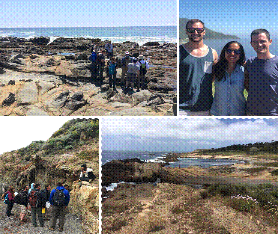
Field work will involve mapping remote areas and will include daily hikes of considerable length. Students should be physically and mentally prepared for work in coastal and mountainous terrain in and around the areas of Pescadero, Napa, Monterey, the Santa Lucia Range, Coalinga, and Gilroy.
Weather in northern California during the spring is generally fine. However, participants should be prepared for hot days (95° F / 35° C), and cold, rainy weather (45° F / 7° C) during storms. Participants should respect the variability in the daily tides and frequently changing weather patterns in the mountain passes.
Lodging for the program will be split between research stations (6 nights), hotel (3 nights) and tent camping (6 nights). Our accommodations will be in and around the cities of Pescadero, Davis, Carmel Valley, Monterey, King City, Coalinga, and Gilroy. Students will need to supply their own ground tarp, tents and bedding (sheets, or sleeping bag).
Color pencils I recommend these inexpensive ones (box of 72). Click Here .
A complete and detailed equipment list will be provided for participants ahead of the camp.
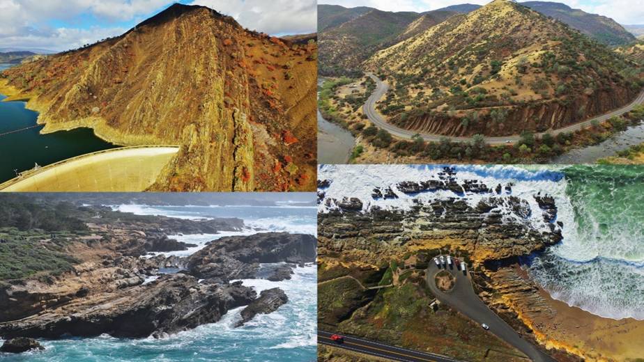
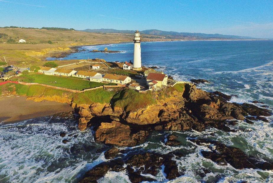
Our trip begins with a visit to the stunning campus of Stanford University, before visiting key locales including (clockwise from top left): Upper Cretaceous Venado Sandstone exposures at Monticello Dam near Napa; Upper Cretaceous Sites Sandstone north of Guinda; Upper Cretaceous to Paleocene Pigeon Point Formation at Bean Hollow State Beach near Pescadero; Paleogene Carmelo Formation at Point Lobos State Reserve. Through this course, students will have the opportunity to map several kilometers of stratigraphy including numerous types of clastic lithologies. Faulting and folding of the strata since deposition and outcrop limits challenge students to think in three dimensions to reconstruct the basin history.
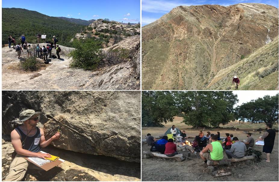
This is a field-intensive program designed to prepare students for careers in industry, government and academic research. A typical day begins with juice, coffee and tea and delicious hot and cold breakfast items. At this time, participants can pack a nutritious lunch to carry with them into the field. Field mapping and instruction lasts from about 8am to 5pm followed by a hearty and filling dinner between 6-7pm. Collaborative post-dinner discussions and presentations (sometimes over campfire, under the stars, while roasting s’mores) help to solidify the observations made during the field day and to plan the mapping program for the next day.
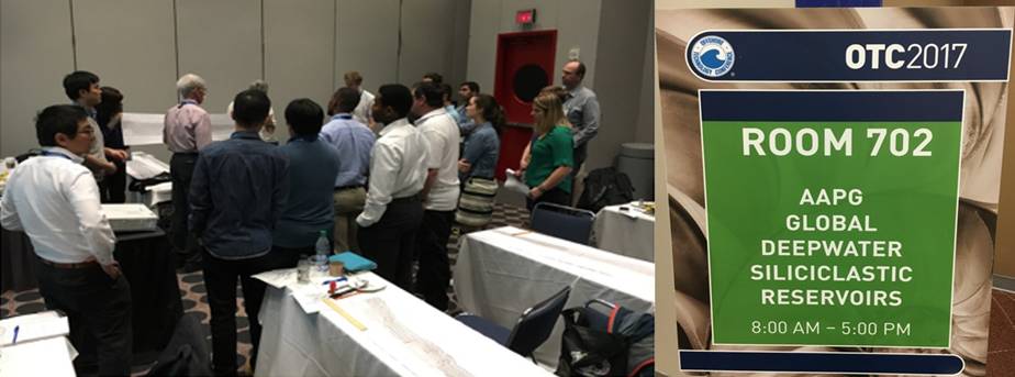
We strive to provide a superior instructor-to-student ratio. We believe this facilitates an unparalleled learning experience. In 2017, this ratio was one instructor for every five students.
We strive to provide a superior instructor-to-student ratio. We believe this facilitates an unparalleled learning experience. In 2017, this ratio was one instructor for every five students.
We strive to provide a superior instructor-to-student ratio. We believe this facilitates an unparalleled learning experience. In 2017, this ratio was one instructor for every five students.
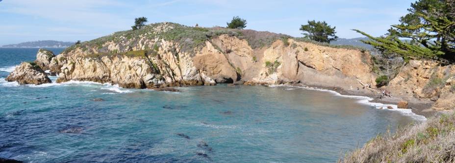
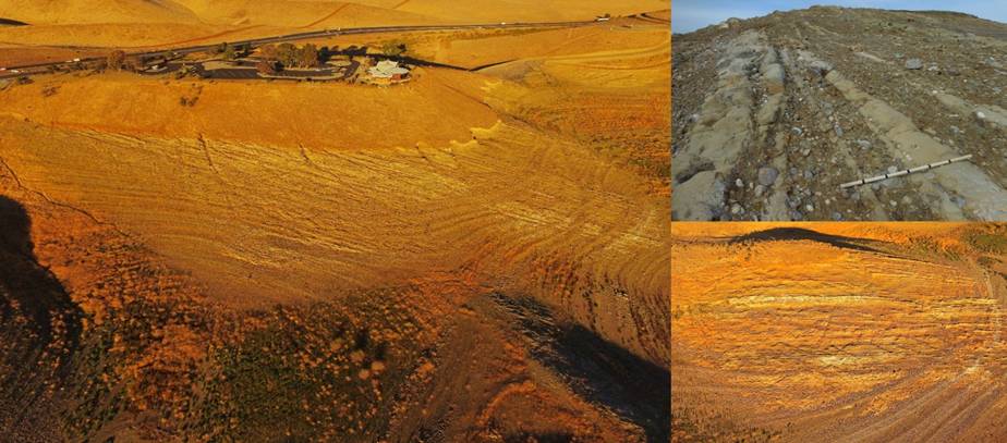
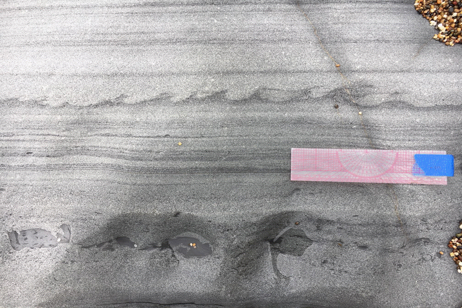
While geologists are taught that sedimentary layers are laterally continuous in our principles of stratigraphy classes, there are numerous examples of how nature does not follow strict rules. Lenticular and poorly sorted conglomerate and sandstone deposited primarily by high-density turbidity currents at Point Lobos State Reserve near Monterey. These deposits of the Paleogene Carmelo Formation are interpreted to represent the fill of an ancient submarine canyon. For years, questions have been raised pertaining to the observed stratigraphic cyclicity in these rocks. These observations will be used to interpret upslope sediment delivery, coastal processes, presence of feeder systems, and fidelity of sequence stratigraphic methods in deep-water depositional systems.
An emphasis on teamwork and positive achievement: collaborative core-log-seismic exercises enhance and enrich the education experience.
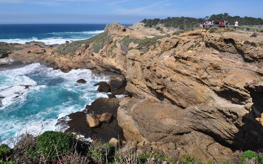
Many of our mapping areas are coastal in nature, for the exceptional outcrops and natural air conditioning provided by the Pacific sea breeze. Exposures of matrix- and clast-supported conglomerate of the Pigeon Point Formation south of Pescadero. In the early part of this field program, we will discuss how fluids, plastics, and thixotropic substances deform with the application of shear stress.
Have you ever wondered how sedimentary basins form and are filled? In this course, we work on a variety of scales – from pore scale to basin scale – to examine the history of the Earth. Do you know what types of flow deposited the rock above? Join our adventure to California to discover for yourself!
Dr. Jon R. Rotzien, Basin Dynamics
1875 Post Oak Park Drive #819
Houston, TX 77027
Dr. Nuri Uzunlar, Director, Black Hills Natural Sciences Field Station
Professor, Geology and Geological Engineering Department
South Dakota School of Mines and Technology
Office Phone: (605) 394 – 2494 ; Cell: (605) 431-1275